TCARI Waterlevels
This program is a simplified interface to create TCARI based waterlevels as used by NOAA. An input TCARI file must be supplied, likely from NOAA’s CO-OPS group, as well as position data. Position data can be supplied in two ways, text data or Caris HDCS Navigation files.
Once the input data files are selected then select the type of tides to be created: verified, observed or predicted. At this point pressing the Create Waterlevels button will download data from the CO-OPS servers as necessary and create output datafiles.
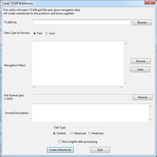
Fig. 20 Blank interface seen at startup
To process ASCII text data containing position and time data (usually ship navigation):
Use the Browse buttons to select the TCARI (.tc) file that was supplied by NOAA, the text files containing position and time data to have water level computed for, and the text format file (.afp) also supplied by NOAA. When the format spec file is selected it will display a description of the format it will read in the Description box as well.
Next, choose the quality type of tide data to apply and if the log file should be displayed after running the program. The tide types are: Verified, Observed and Predicted. Verified and observed are based on actually observations at the tide stations where the verified data has been checked and corrected by NOAA but is not immediately available. Observed data is available sooner but may contain noise. Both require internet connectivity to download tide data from NOAA. Predicted tides does not require internet but also is the least accurate as it only uses harmonic constituents to create an estimate of tide. This is useful for planning or quick analysis before verified data may be available.
There is a sample ASCII text dataset to accompany the TCARI program and it’s format spec AFP file as well as the resulting output files. Data will be output to the same format as what was entered with the water level and uncertainty appended in the last two columns. Fig. 21 shows what the dialog may look like after selecting all options.
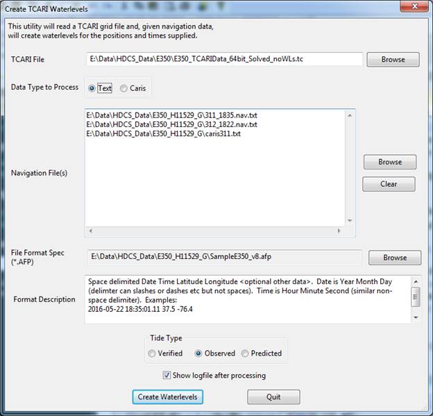
Fig. 21 Filled user interface using Text data
CARIS
Support for Caris HDCS data is also included. Choose the Caris option from the Data Type radio buttons and the dialog will change to show slightly different options.
The Browse button for Navigation File(s) will now open a specialized selection box for Caris data. You can browse to your data and hold control or shift to multi-select line directories. Alternatively you can select a Caris project, vessel or day directory and press Descend/Confirm and it will automatically highlight any subdirectories that contain recognized Caris Navigation files.
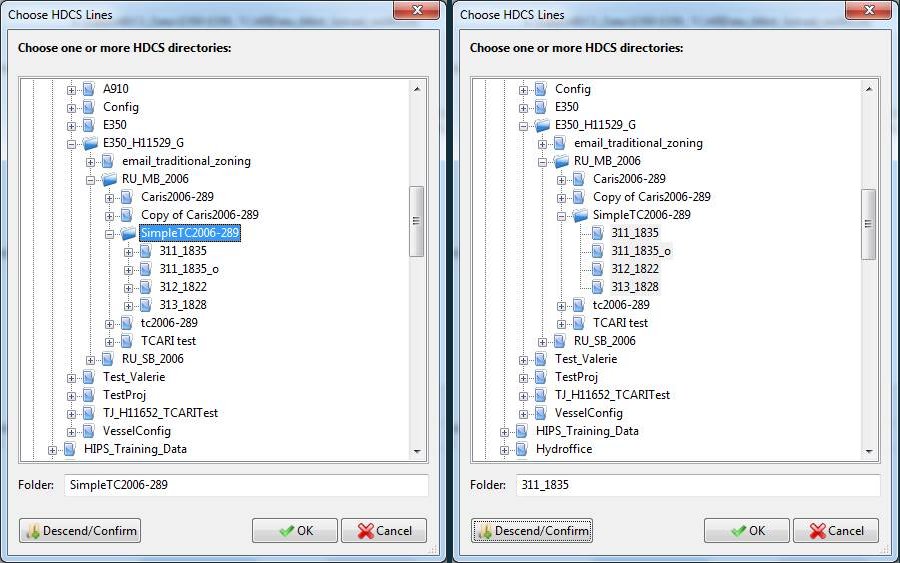
Fig. 22 HDCS Selector before and after pressing descend/confirm
To process Caris data you must also have a valid caris license. By supplying the path to the Caris “.sit” file the caris reading software will be initialized. At this point your screen make look like this:
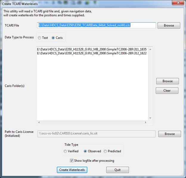
Fig. 23 User interface filled for Caris data
Resources
- Online Resources:
Contact
If you find errors in the documentation or want to contribute, you are encouraged to email the following personnel emails @NOAA.GOV
- barry.gallagher
- jack.riley
- chen.zhang
- eric.younkin