Line Planning: Numbering
NOTE: When selecting a layer in an ArcMap tool it operates on the SELECTION - so you can intentionally OR ACCIDENTALLY choose a subset of lines/polygons to work with.
If a layer of lines (or polylines) is loaded then the Number Survey Lines tool can be used. It will add a LineNumbers column to the table or replace the existing one. The tool can will number lines using an incrementing number but can also add prefix or suffix to the line numbers generated.
Recall the output from the Fill Polygon With Lines tool:
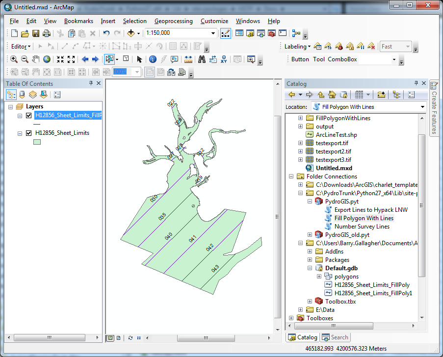
Fig. 7 Output from Fill Polygon with Lines
Running the Number Survey Lines tool, select the line layer to be numbered. Since the existing lines start at 22 then this example shows them to be re-numbered starting from 1. Further this prefix and suffix are supplied below. This will result in a naming pattern like “100_XXX__tst” where XXX is the number for the line. After finishing the table would show 100_001_tst, 100_002_tst, 100_003_tst and so on.
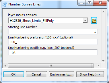
Fig. 8 Options dialog
After running the tool and updating the labels we get the display below. The numbered lines are now ready to export to LNW format or be hand edited or re-numbered as needed.
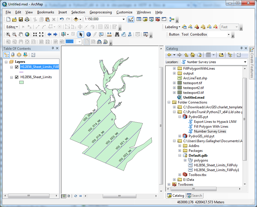
Fig. 9 Labeled lines